MEESO
Ecologically and economically sustainable mesopelagic fisheries
The project aims to map ways to sustainably utilize mesopelagic species.
Start
01. Jan 2019
End
31. Jan 2024
Funded by
EU - Horizon 2020
Cooperation
The Institute of Marine Research, Marine Institute, SINTEF Ocean, Fundación Azti, Marine and Freshwater Research Institute Iceland, Wageningen University, Danmarks Tekniske Universitet, University of Strathclyde, International Council for the Exploration of the Sea, Liegruppen Fiskeri, World Maritime University, Collecte Localization Satellites SA, IMAR – Instituto do mar, United Kingdom Research and Innovation, TEAGASC – Agriculture and Food Development Authority, Pelagia AS, Bord Iascaigh Mhara, EUFISHMEAL
Project Manager(s):
Other Participants:
Background
Global human population growth is causing increased demand for food, including marine proteins and lipids. Mesopelagic organisms represent the largest unexploited resource left in the world’s oceans. Meeso will determine the potential of sustainably exploiting the mesopelagic biomass.
Aim
The overall aim of MEESO is to quantify the spatio-temporal distributions of biomass, production and ecosystem role of mesopelagic resources and to assess options to sustainably manage and govern their exploitation.
MEESO website
You can find more information and follow the project progress on the MEESO website.
Project activities
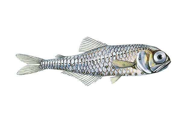
MEESO will demonstrate and implement new acoustic and trawl-sampling solutions which will allow quantification of abundances and spatial distributions of the mesopelagic resources. MEESO emphasises the abundance and ecological importance of two key fish species, Benthosema glaciale (lanternfish) and Maurolicus muelleri (deep-sea pearlside). In many places species of krill, pelagic shrimps, squids and jellyfishes, as well as other fish species, dominate mesopelagic diversity and biomass, and assessing their abundance, distribution and ecological role will be an important part of MEESO. It will quantify drivers of the mesopelagic biomass and its role in sequestering carbon from the atmosphere. Recent advances in survey methods will be implemented on current monitoring surveys for time series generation.
The MEESO field campaign will be a joint effort between academic institutions and the industry, involving research as well as fisheries vessels. Major parts of the central and eastern North-Atlantic Ocean will be surveyed, including the Nordic Seas. The mesopelagic ecosystem will be mapped from the continental shelves to the deep oceans and across oceanic ridges. North-south and east-west transects will encompass biological, chemical and physical gradients, e.g. primary production, biomass of epipelagic populations (including commercial fish stocks) and sea-bottom topography.
The potential for fisheries will be mapped. Many dedicated mesopelagic cruise have already been conducted since 2016, and the data from these will be available to MEESO. The MEESO partners will also make available for analyses within the project data from a range of standard monitoring cruises.
Additionally, numerous scientific and commercial trial cruises are planned. MEESO will concurrently deploy single-species, multi-species and ecosystem-assessments, and provide a roadmap for their application beyond the project under an ecosystem-based approach for the management and governance of mesopelagic fisheries. These will be tailored to the unique nature of the mesopelagic ecosystem while accounting for the unavoidable uncertainties implicit in the exploitation of a new resource. Focus will be on both fishery and ecosystem sustainability while accounting for the values, needs and expectations of society in the context of the United Nations Sustainable Development Goals (UN SDGs).
Updates from the project (meeso.org)
Publications
The picture of the lantern fish is unchanged. Source: Jan Fekjan, Licence: CC BY-SA 4.0
Topics
Fisheries
Files and Links